Gujarat on alert: Heavy rain to continue as monsoon system moves in
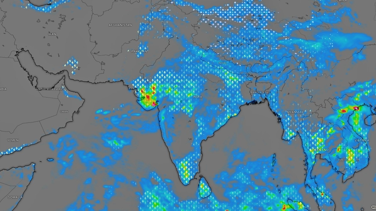
The weather is set to remain active across parts of western and central India on Tuesday, with a low-pressure area continuing to influence rainfall patterns over Gujarat and Rajasthan even as conditions begin to turn favourable for the eventual withdrawal of the Southwest Monsoon.
According to the India Meteorological Department (IMD), a low-pressure area over southeast Rajasthan and adjoining north Gujarat remains the dominant weather system affecting the region.
The system has already triggered intense rainfall activity, with isolated extremely heavy rainfall expected over Saurashtra and Kutch, while parts of the Gujarat region could receive very heavy showers.
As the system evolves, its associated weather activity could continue to influence rainfall across parts of Rajasthan, Gujarat and central India on Tuesday.
Adding to the complex weather pattern is a trough, or an elongated region of relatively low atmospheric pressure, stretching from the cyclonic circulation associated with the low-pressure area towards Jharkhand through Madhya Pradesh and north Chhattisgarh.
This atmospheric feature could help transport moisture and support cloud formation and rainfall over parts of central and eastern India.
Meanwhile, another upper-air cyclonic circulation has formed over the northwest Bay of Bengal and adjoining coastal areas of north Odisha and West Bengal. This system is located in the lower and middle levels of the atmosphere and could influence rainfall activity over eastern parts of the country.
A separate trough extending from south interior Karnataka towards the southwest Bay of Bengal is also expected to keep weather conditions active over parts of peninsular India.
For northwest India, however, the larger seasonal picture is beginning to change.
The IMD said conditions are becoming favourable for the withdrawal of the Southwest Monsoon from some parts of west Rajasthan around September 19.
The withdrawal of the monsoon from Rajasthan usually marks the beginning of its gradual retreat from the Indian subcontinent.
This means India could be entering a transitional phase where some regions continue to experience heavy rain due to local weather systems, while the broader monsoon circulation begins weakening over northwest India.
A Western Disturbance, an atmospheric system moving in from the west, is also present as a trough in the middle levels of the atmosphere.
For Tuesday, the key weather story is likely to remain the continued rainfall activity over western and central India, particularly Gujarat, while the countdown to the monsoon's seasonal withdrawal from northwest India begins.- EndsPublished By: Sibu Kumar TripathiPublished On: Sep 15, 2026 07:30 IST