New Mexico Flash Flood Emergency as McLeod Dam Faces Imminent Failure - Newsweek
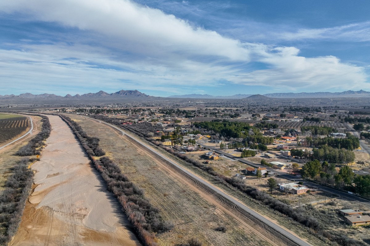
A New Mexico dam neared failure Tuesday as remnants of Hurricane Polo moved north from Mexico, threatening flash flooding across a broad swath of the Southwest, Plains and Midwest.
The National Weather Service (NWS) issued multiple Flash Flood Emergencies in southern New Mexico, including one covering the Hatch Valley in Doña Ana County, where residents were urged to evacuate because of the imminent failure of McLeod Dam.
Officials also warned residents in Hatch, Garfield, Salem, and Rincon to seek higher ground. Schools in the Hatch Valley announced they would close Wednesday.
Video posted to X on Tuesday night showed flooding in the Hatch area depicting stranded vehicles, water overflowing roads, and standing waters preventing travel.
“SEEK HIGHER GROUND NOW!” the NWS office in Albuquerque said in an emergency bulletin, warning that the flooding was life-threatening.
The flooding threat was expected to expand eastward and northward through the week as moisture from Polo combined with another tropical system in the eastern Pacific, Tropical Storm Rachel, and a slow-moving weather system over the Southwest.
A Flood Watch was in effect across 10 states Tuesday, with additional areas expected to be added in the coming days.
The highest flood risk through Wednesday included parts of Arizona, New Mexico, Colorado, Kansas, Oklahoma, and Texas. The threat was expected to spread into the central United States later in the week, with heavy rain possible from Texas to Minnesota.
Nearly 80 trillion gallons of water could fall across the United States this week, according to weather forecasts. That amount would be equivalent to more than 122 million Olympic-sized swimming pools.
Polo made landfall Monday night in Mexico's Baja California Sur before weakening from a hurricane Tuesday. Its remnants were moving north toward the United States, carrying large amounts of tropical moisture.
In southern New Mexico, a stream breached levees near a water treatment plant in Rincon, threatening nearby buildings, according to officials. The NWS said several dams were near full because of intense runoff.
The weather service warned that the combination of saturated ground and additional heavy rain could produce dangerous flash flooding, particularly in areas affected by wildfires.
The remnants of Polo are expected to move into eastern Colorado early Wednesday, where forecasters warned that some areas could receive several times their normal September rainfall in a single day.
Moist air moving into mountainous terrain could further increase rainfall through a process known as orographic lift.
Forecasters also warned of flash flooding and mud flows in wildfire burn scars, including areas of southern Colorado affected by the Aspen Acres Fire.
Beyond the Southwest, heavy rainfall was possible across parts of Arizona, Utah, Nebraska, Iowa, Illinois, Missouri, Kansas, Oklahoma, and Texas through at least Thursday.
Some areas had already experienced flooding Monday and Tuesday. In Arizona, authorities reported several water rescues, including people who became trapped in flooded vehicles.
The threat was expected to continue into the weekend as the remnants of Polo interacted with a slow-moving frontal boundary across the Plains.
That boundary could provide a focus for additional thunderstorms and heavy rain from Wednesday through Friday. Moisture from Tropical Storm Rachel was expected to add to the system later in the week.
“We’re looking at least a couple of days of heavy rain in the southern Plains,” Frank Pereira of NOAA’s Weather Prediction Center told Newsweek Tuesday night. “That will be winding down Friday, then going into the Southeast Friday and Saturday.”
Forecasters warned that some locations could receive repeated rounds of heavy rainfall, increasing the potential for flash flooding even in areas that do not typically experience significant flooding.
The National Weather Service's Weather Prediction Center was forecasting three consecutive days of a moderate risk for excessive rainfall from Tuesday through Thursday. Moderate risk is Level 3 on the agency's four-level scale.
The threat comes as parts of New Mexico, Colorado, Oklahoma, and Texas remain in drought despite the expected heavy rainfall. Forecasters cautioned that rainfall occurring too quickly can produce dangerous flooding rather than immediately alleviating drought conditions.
Newsweek’s reporters and editors used Martyn, our AI assistant, to produce this story. Learn more about Martyn here. Contact Newsweek editors on this story: Edward T. Cummins