Unpredictable, uneven, unorganised: How the 2026 monsoon kept India guessing
By the time the last monsoon clouds retreat, India's 2026 rainy season could end up in the record books as "normal". The all-India monsoon rainfall assessment may suggest that the country received what it was supposed to.
But behind that seemingly reassuring number lies a season of staggering contradictions, one in which some regions waited desperately for rain, others battled relentless downpours, and the monsoon seemed to follow a rhythm of its own. People walk on the road during rain in Ahemdabad, Gujarat. (Photo: Unsplash)
Between June 4, the day the southwest monsoon officially arrived in India, and September 26, India recorded 749.2 mm of rain against a normal of 853.4 mm, marking a 12% deficit, according to IMD Hydromet data.
That's still inside the "normal" range the India Meteorological Department (IMD) uses.
But to stop at just that number is to miss the whole picture, because that number is an average of a season that, region by region, looked far from normal. Students play at Kartavya Path amid monsoon showers, in New Delhi. (Photo: PTI) A SEASON THAT NEVER SETTLED
Nothing about monsoon 2026 has been smooth.
It started slowly as June's rain arrived late and fell well short of what's typical for the month.
Low-pressure systems brewing over the Bay of Bengal, that pull in moisture from the ocean and often bring heavy rain once they hit land, kicked into gear and soaked eastern and central India. But that recovery never spread evenly. Some places got their rain back. Most didn't.
Akhil Srivastava, scientist at the IMD, said that unevenness is really the story of the whole season, not just July. As he put it, "the season has seen dry spells punctuated by intense rainfall events over some parts of the country." People wade through a waterlogged road amid heavy rain, in Gurugram. (Photo: PTI) 'NORMAL' BUT NOT ENOUGH
Break the national number down by region and the cracks start to show.
East and Northeast India got 1,008.1 mm against a normal of 1,337.9 mm, a 25% shortfall. South Peninsular India was down 23%. Northwest India was 9% short. Central India came closest to a normal season, facing a deficit of just 1%.
The state-by-state picture is even messier. A skyline landscape of Mumbai under an overcast sky as rain falls. (Photo: Unsplash)
Meghalaya, usually one of the wettest places in the country, has slipped into the "large deficient" bracket with a 60% shortfall, its worst level yet this season. Meanwhile, Manipur is down 44%, and Arunachal Pradesh is down 43%.
Head north and Punjab, the state most people associate with India's grain supply, is sitting at a 42% deficit, with Haryana down 25%. It's a similar story in the south and west: Kerala is 27% short, Karnataka 29%, Goa 33%.
And then, right in the middle of all that shortage, Odisha has 31% more rain than it normally gets.
This is the paradox sitting at the heart of the 2026 monsoon: a national number that reads "normal" while masking deficits large enough to threaten crops and water supplies across huge swathes of the country. People use a boat to wade through a flood-affected area at Banki, Odisha. (Photo: PTI)
Mahesh Pahlawat, Vice President of Meteorology & Climate Change at Skymet, explained why Odisha kept getting soaked while others waited.
"Rather than spreading out, several Bay of Bengal systems this year funnelled repeatedly toward Odisha and Vidarbha, stacking rainfall in the same eastern-central belt again and again while other areas kept waiting," he said.
Srivastava noted how geography made that funnel effect worse.
India's hills and mountains force rain-bearing winds to drop their moisture on one side and leave the other dry, what geographers call "classic windward-leeward divides." People walk amid rain in Kolkata. (Photo: PTI)
This year, he said, that natural split was sharpened further by dry, sinking air linked to El Nino, a periodic warming of the central Pacific Ocean known to weaken India's monsoon. That dry air, he explained, "acted as a barrier that suppressed cloud formation and moisture transport just a few hundred kilometres away from surplus rain zones."
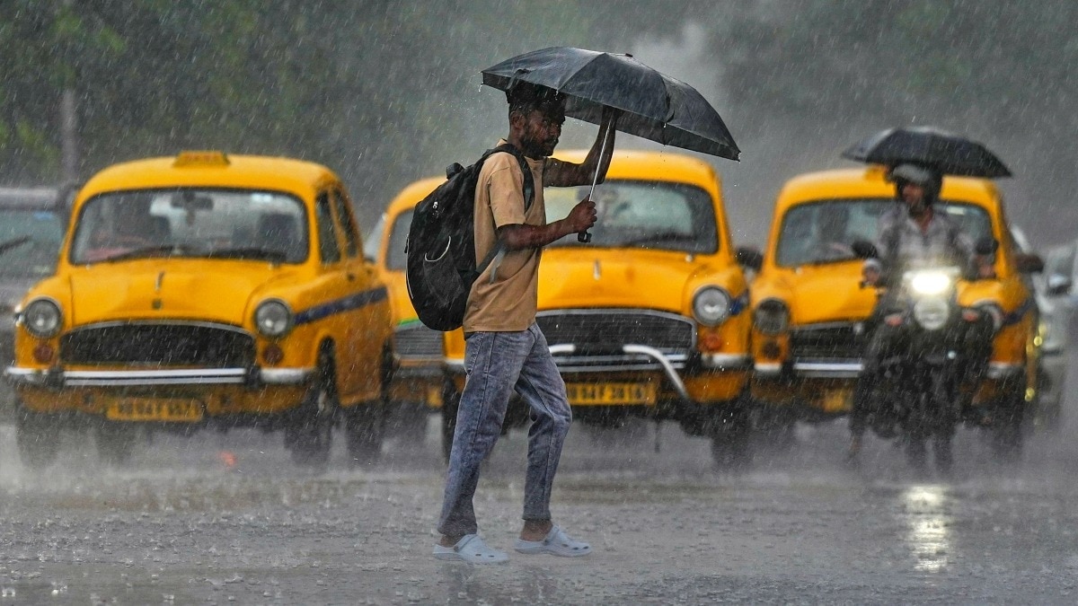
In other words, some places got hit by the storm systems again and again, while a belt of dry air sitting right next door kept rain from ever reaching the region beside it. An auto-rickshaw plies throguh heavy monsoon rain. (Photo: Getty)
The IMD's rainfall data backs this up; 14 states and Union Territories, about 36% of India's land area, fell into the deficient category.19 states and UTs, covering 57% of the area, landed in the normal zone, while just three states covering 7% saw excess or large-excess rainfall.
On paper, India looked fine. On the ground, it looked anything but uniform.#WATCH | Delhi: Relief from heat as rain lashes parts of the National Capital; Visuals from Firoz Shah Road pic.twitter.com/OrSdEya1ux— ANI (@ANI) May 30, 2026BAY SYSTEMS COULDN'T HELP
It would be easy to assume the Bay of Bengal simply didn't produce enough storms this year. But that's not what happened.
Dr Kaagita Venkatramana of TERI's Centre for Climate Modelling said roughly the usual number of systems formed over the Bay. What let the season down was their strength and their range.
Most stayed weak, at what meteorologists call depression strength, and lost momentum soon after coming ashore, never making it far inland.
Part of that, she explained, comes down to the monsoon trough, which is the band of low pressure that usually drags rain right across the country in long, steady spells.
"The trough which just didn't hold together long enough this year to carry storms further than the coast," Venkatramana said. A low pressure system from the Bay of Bengal moving in during August 2026. (Photo: IMD)
Srivastava traced exactly where that shortfall landed.
"The storm tracks remained largely confined to central India and neighbourhoods, dropping rain over and around Odisha, Chhattisgarh, and Madhya Pradesh," he said. While the trough's repeated pull northward meant less moisture over northwest India, mainly Punjab, Haryana and Rajasthan, Srivastava added.
That is the reason Odisha's 31% surplus is right beside a 25% deficit across the wider east and northeast region, while central India got away with a 1% deficit.
There's a bit of good news, though.
Pahlawat pointed to a fresh low-pressure area that had grown into a Deep Depression last week, helped cut the national deficit meaningfully, enough that the "season could probably end with an 11% deficit, or else [without the system] it would have been around a 15% deficit." A boy walks with an umbrella amid heavy rain. (Photo: Getty) advertisement"DAYS OF RAIN IN AN HOUR"If there's one thing that defines this monsoon more than how much rain fell, it's how that rain arrived.
Venkatramana described a season of long dry stretches interrupted by short, intense bursts, rather than rain spread evenly across the weeks.
Assam illustrated exactly how strange that makes the numbers look; the state ended up with a 26% rain deficit and still saw flooding, because whatever rain it got came all at once instead of trickling in gradually.
Pahlawat linked that pattern to a warming atmosphere, a warming planet.
"As the air gets hotter, it can hold more moisture, so instead of releasing rain steadily, it holds on longer and then dumps it all at once," he explained. "Essentially, four days of rain now falls in a single day." Rickshaw puller wades through the flooded street after rain in Guwahati, Assam. (Photo: PTI)
This year, El Nino too nudged the season toward being drier overall.
Normally, a counter-pattern in the Indian Ocean called the Indian Ocean Dipole (IOD) can help offset that, but this year it stayed mostly neutral.
"The IOD failed to provide a counterbalancing moisture boost," Srivastava said.
On top of that, a recurring band of storm activity that circles the globe every few weeks, known as the Madden-Julian Oscillation (MJO), got off to a weak start in June that "affected the rainfall momentum during monsoon onset month," before flipping between active and quiet phases for the rest of the season. A satellite image shows a warming Pacific Ocean due to El Nino. (Photo: Windy)
Still, none of the three experts treats El Nino as the whole story. Where individual storms went, how strong they were, and where exactly they made landfall did the rest of the work in deciding who got soaked and who didn't.
And that's really the trap in judging a monsoon by its seasonal total alone.
A region can end up close to its long-term average on paper while the actual experience on the ground was feast-or-famine; weeks of dry, cracked soil followed by flash floods overnight. (Source: IMD)
Which is why, for farmers, reservoir managers and city planners, "how much rain fell this season" isn't really the useful question anymore.
When it fell, how fast, and how it was spread out matter just as much as the total itself.- Ends
Aryan Rai is a sub-editor at IndiaToday.in, working to process and proofread the daily coverage of national and international news. Aryan joined India Today in 2024. He began his career in journalism in 2021 while doing his postgraduate degree in journalism in Boston, US.
Before joining the India Today Group, Aryan worked as a reporter in the US, covering climate change, local and state politics, immigration and food insecurity.
Aryan studied engineering as an undergraduate student but pivoted to journalism because of his love for writing and staying informed on issues. He is particularly interested in political and environmental journalism and is fluent in English and Hindi.
In his free time, he prefers to cook, binge-watch TV shows, read and write fiction, and annoy his dog.